At the very end of June, after a long day driving around the Ring of Kerry we headed toward Dingle with a stop off at Inch Beach during tumultuous weather.
The weather calmed as we arrived at Dingle’s Brambury Guest House and our hostess encouraged us to hop in the car and drive Slea Head. With now-perfect weather, we shouldn’t risk missing the views! The day before, we’d abandoned plans to drive the Skellig Ring due to rain and low visibility.

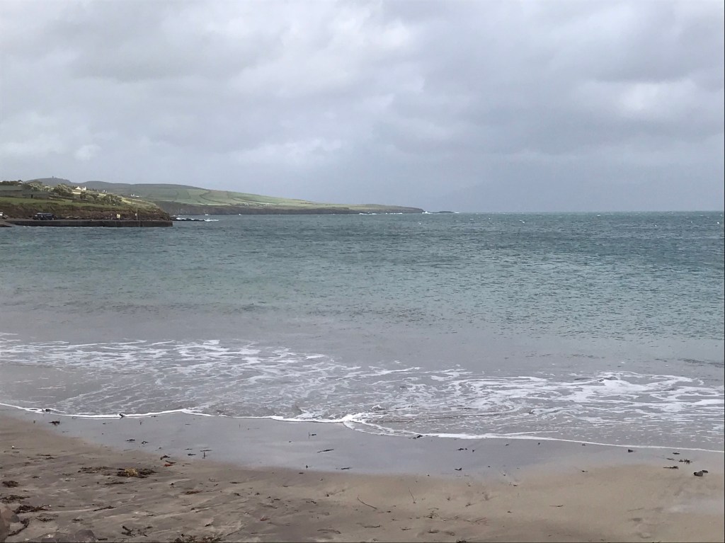
Our first stop after leaving Dingle for Slea Head was Ventry Beach—a bit cold, but pretty in the glimmers of sun.
We stopped for a glimpse of an old fort that is tumbling into the sea but it wasn’t open. Frankly it doesn’t look either safe or as if it can be saved from the sea. But there is a gift shop that was just closing its doors when we arrived:

The cliffs here are impressive, and the fort is sliding right off. It’s not pictured, as all I could capture was scaffolding and fence.

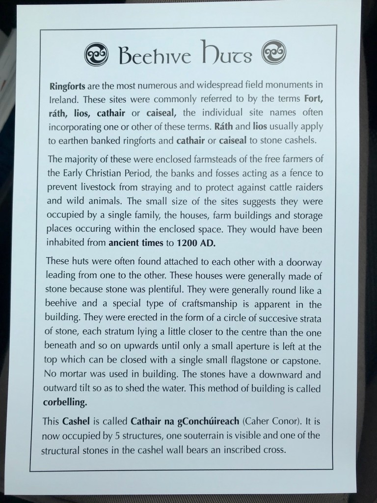
Bee Hive Huts
Our next stop was the Beehive Huts, a cluster of houses situated within one large circular compound.


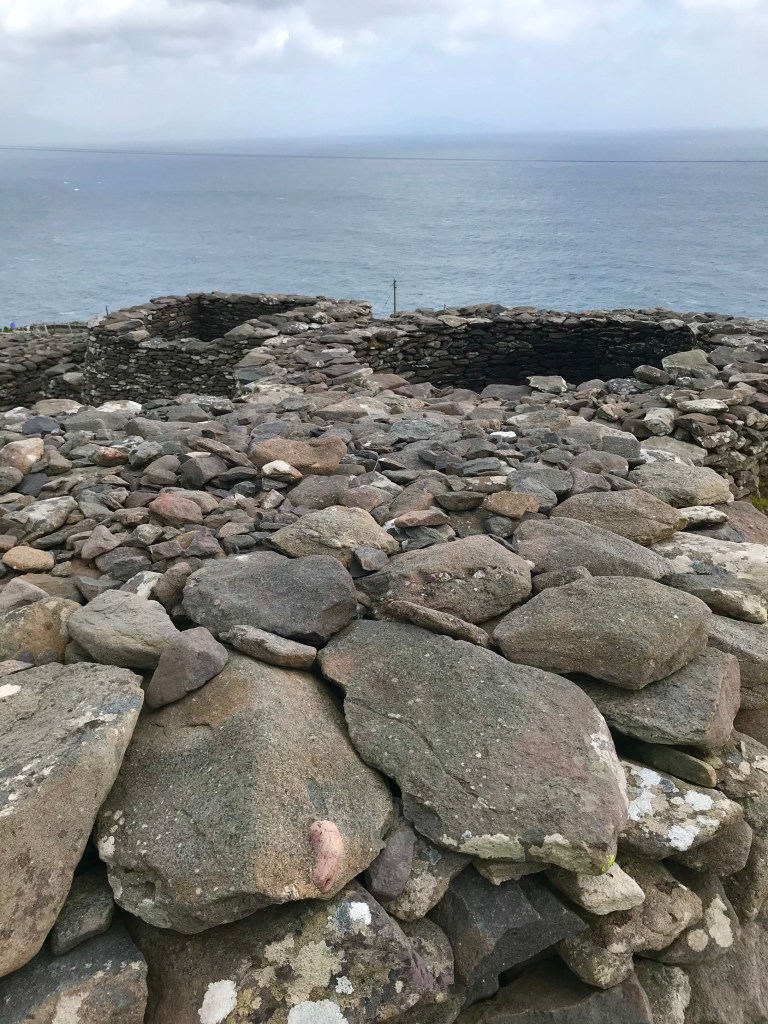
I’d guess that you must pass over a farmer’s land to arrive at here from the road. I say this as the site is publically maintained but there’s a man collecting a €3 fee per person.

Many such sites exist on privately-owned land and can’t be viewed (without great will and determination). Paying €3 is the easy way to go! It a fascinating place to behold.
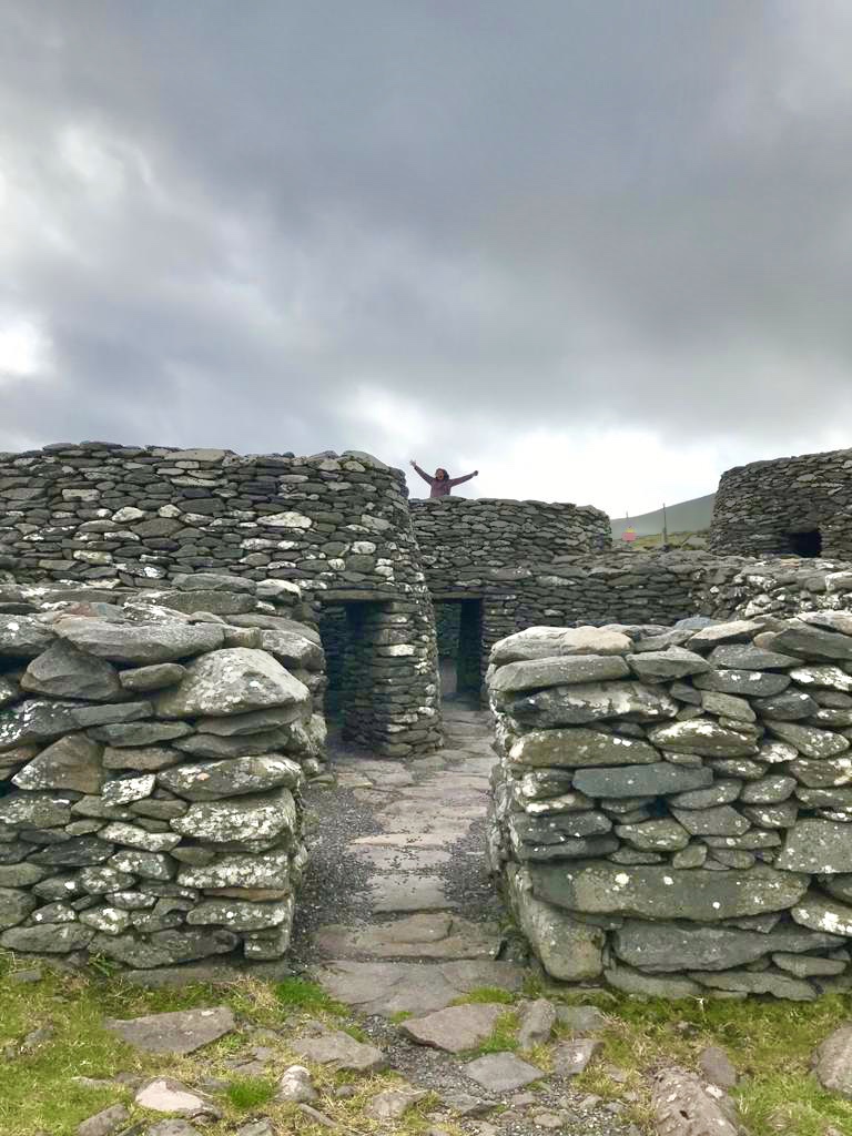


The €3 got us each a cess and a copy of this information sheet:
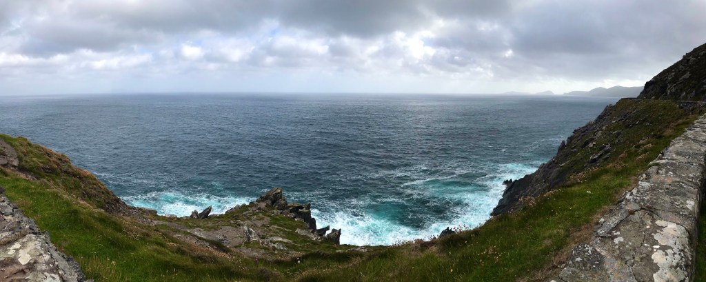
Slea Head
The very western end of the Dingle Peninsula is called Slea Head. The Atlantic pounds these cliffs, day in, day out.
The water is so very blue!
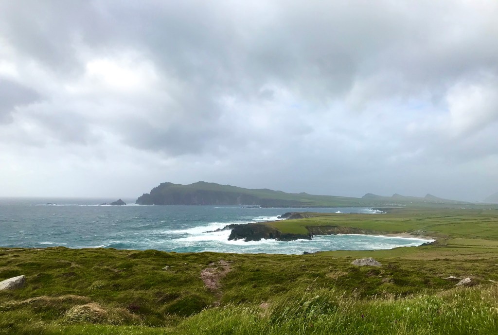
And there are views of the Blasket Islands, just beyond Slea Head:


The bit of land shown below has always stayed in my memory, since my first trip around Slea Head in 2003. It’s less dramatic in a camera phone photo, as it gets flattened out. In person it’s quite impressive.
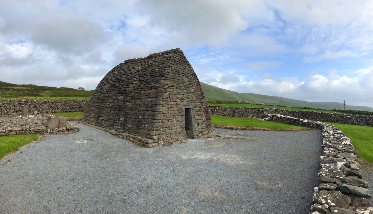
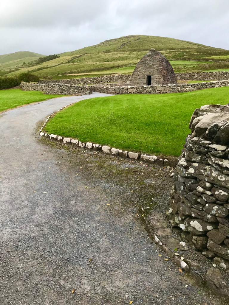
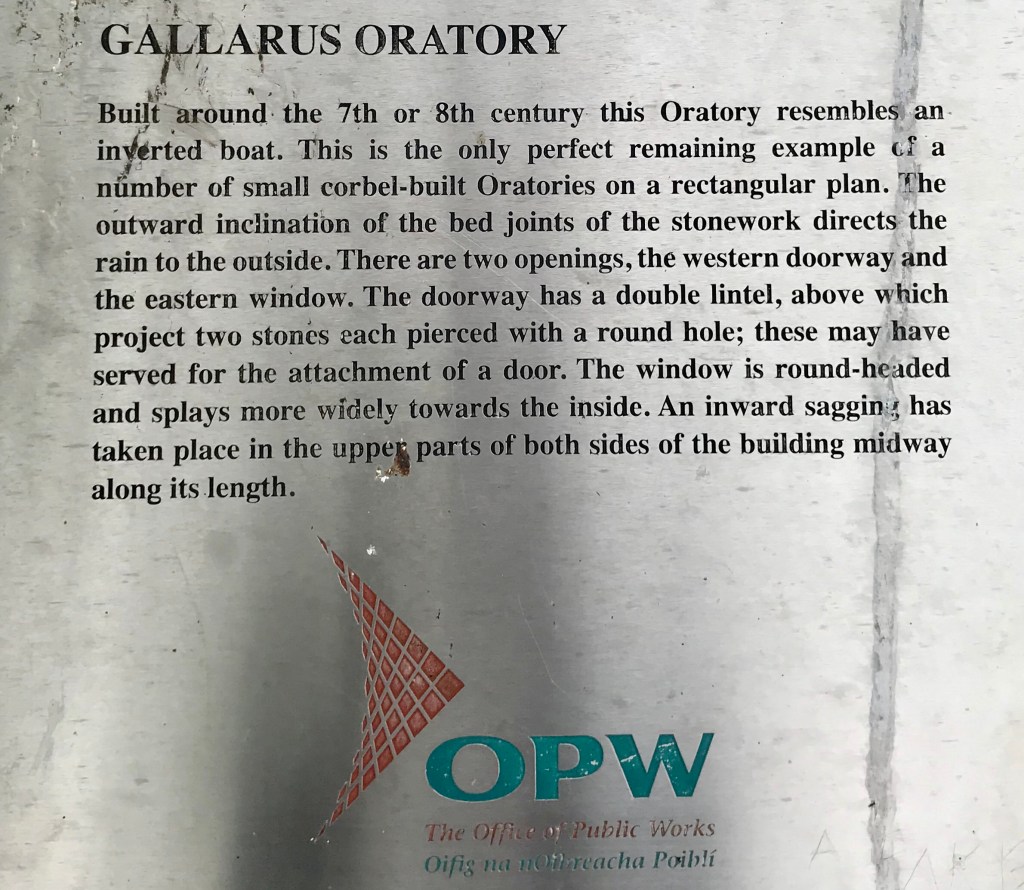
Gallarus Observatory
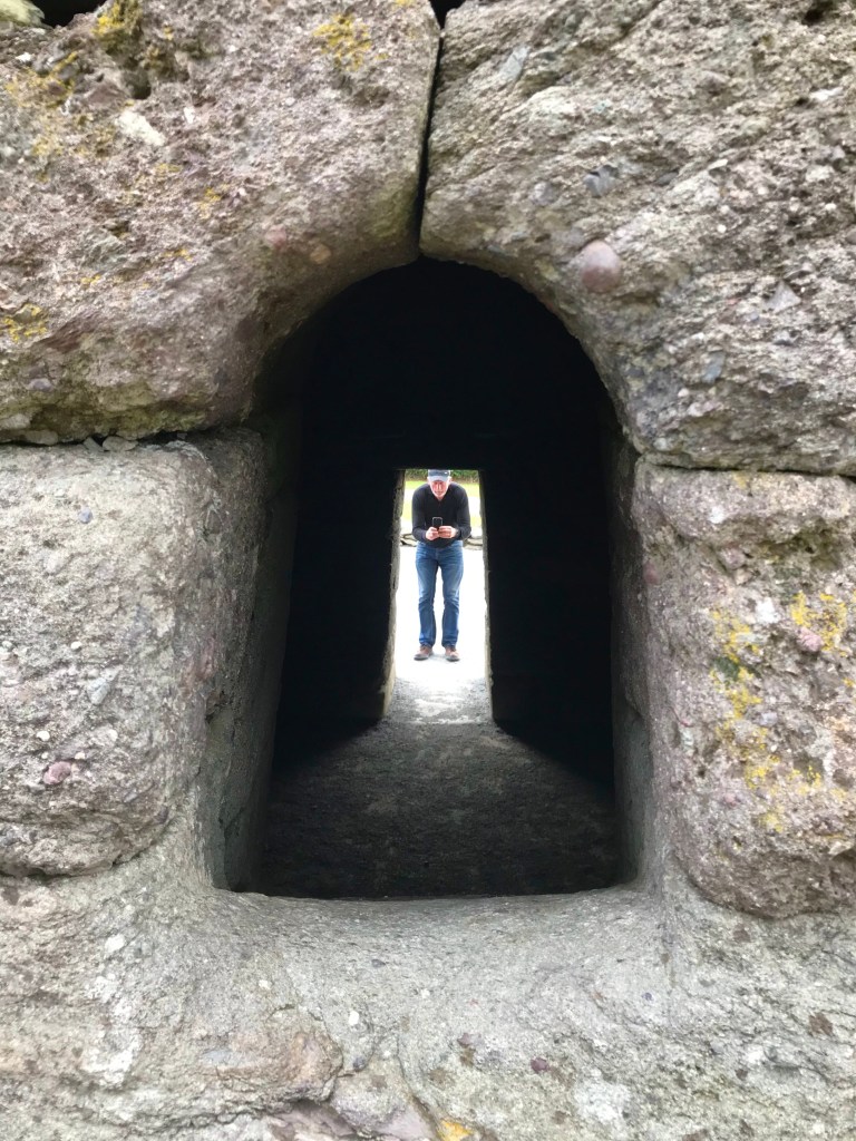
An addition, indelible, memory of the 2003 trip was our visit to Gallarus Observatory, an ancient church of dry stack stone. Not a bit of mortar was used. Yet the place still stands today. Amazing ingenuity and craftsmanship.
This plaque explains how the edifice was constructed:
Indeed, during Europe’s Dark Ages, when most knowledge was forgotten, monks were hard at work on the nearby Blasket Islands, copying religious texts by hand and keeping literacy alive.


It is awe-inspiring to think of what a few dedicated and hard-working individuals were able to do for humanity.

Leaving that kind of legacy is why I became an architect. But today, instead of designing buildings, I design with words.


Kilmalkedar Church
I find the hour or so I spent at Kilmalkedar Church in 2003 is also etched in my being. That’s why I wanted to share it with Aongus as well. It’s just a few minute’s drive from Gallarus Observatory.
Fortunately we saw a humble little print out on the wall of the Observatory gift shop (outside, as the shop itself was still closed in the aftermath of Lockdown). It told us the name of the church so we could search for it on Google Maps.
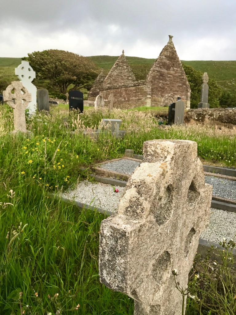
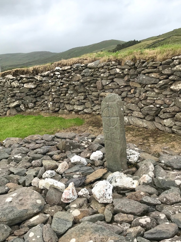
Kilmalkedar Church is surrounded by a cemetary.
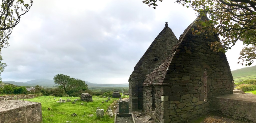
It was built in the 1100s, and is thus much newer than Gallarus Observatory which may date back as far as 600 AD.


In true Irish fashion, the cemetery extends inside the church walls.


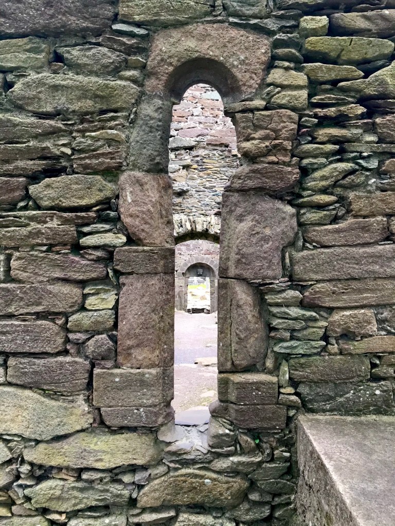

And you’ll find ancient markers here,

and there!

The drive around Slea Head offers thousands more fabulous views, not captured here, and many opportunities to stop and explore the many gorgeous (but cold) beaches.
I wish for you a sunny drive around this peninsula someday, and many happy returns for Aongus and me as well.

